Caspian Sea Region
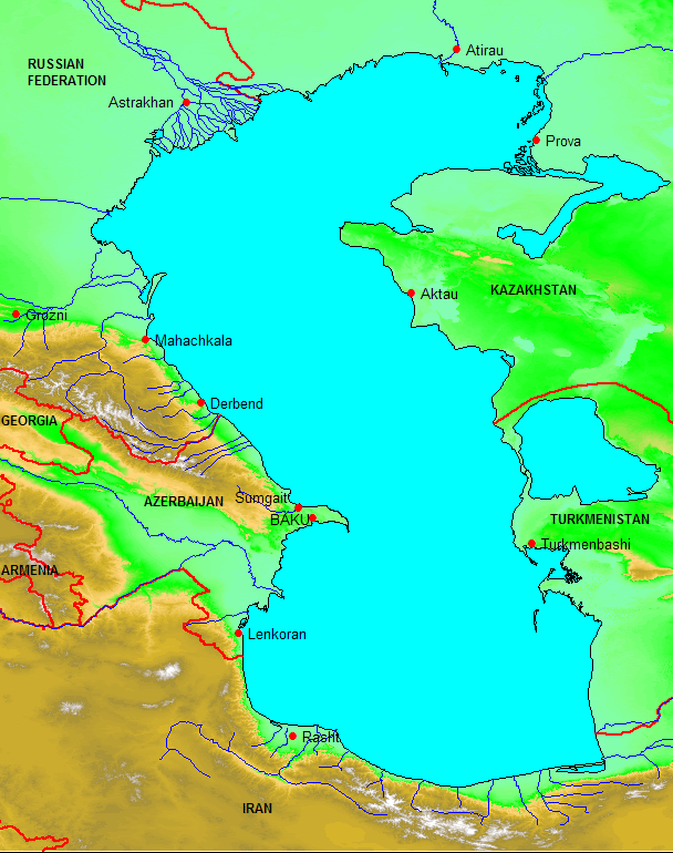
Elevation derived from SRTM-3, with national boundaries from Digital Chart of the World,
coastline and rivers from the Caspian Environment Programme.
Map generated by Ken Campbell using MapInfo and Vertical Mapper
independent international consultants
Caspian Sea Region